30DayMapChallenge 2022
Last month I took part in my first 30DayMapChallenge – a daily mapmaking challenge that takes place in November each year.
Last month I took part in my first 30DayMapChallenge – a daily mapmaking challenge that takes place in November each year.
For the graded assignment in the Introduction to Mapping, Spatial Data and GIS course I completed in June I made the following map:
Things I got up to in the last week:
Some rambles about each of those:
Just a few things to note this week:
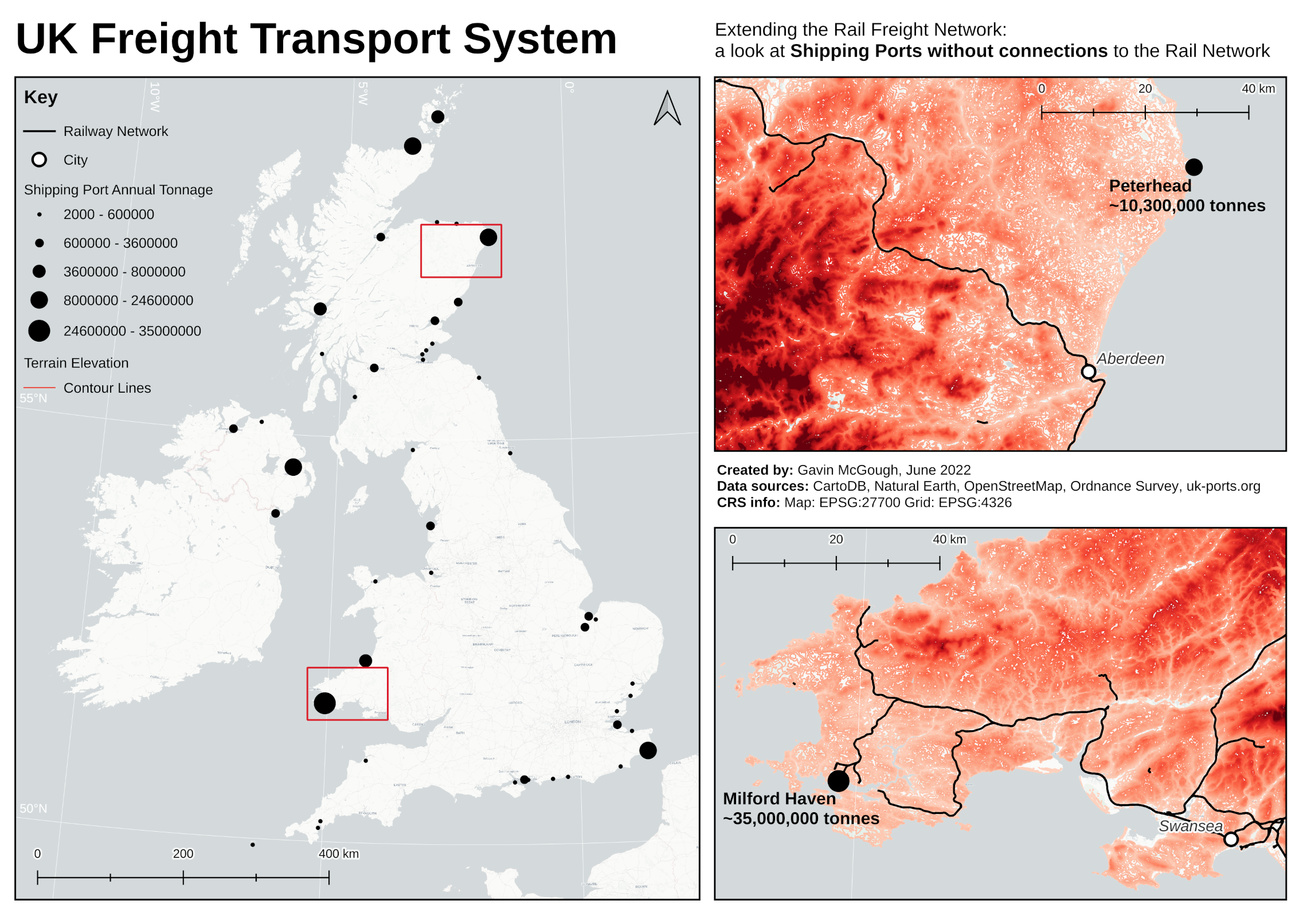
In Lesson 4 of GEOG 868 I completed a site selection using PostGIS.
A few things I got up to this week:
The Making Maps unit for the Introduction to Mapping, Spatial Data and GIS course I completed in June featured a tourism case study. The exercise that week was to create a tourist map of Melbourne in Australia.
Oops, my first late weeknote! I intended to get it done at the weekend rather than on Wednesday like usual, but that has ended up slipping over to today, Monday. Anyway. What GIS things did I get up to since my last post?
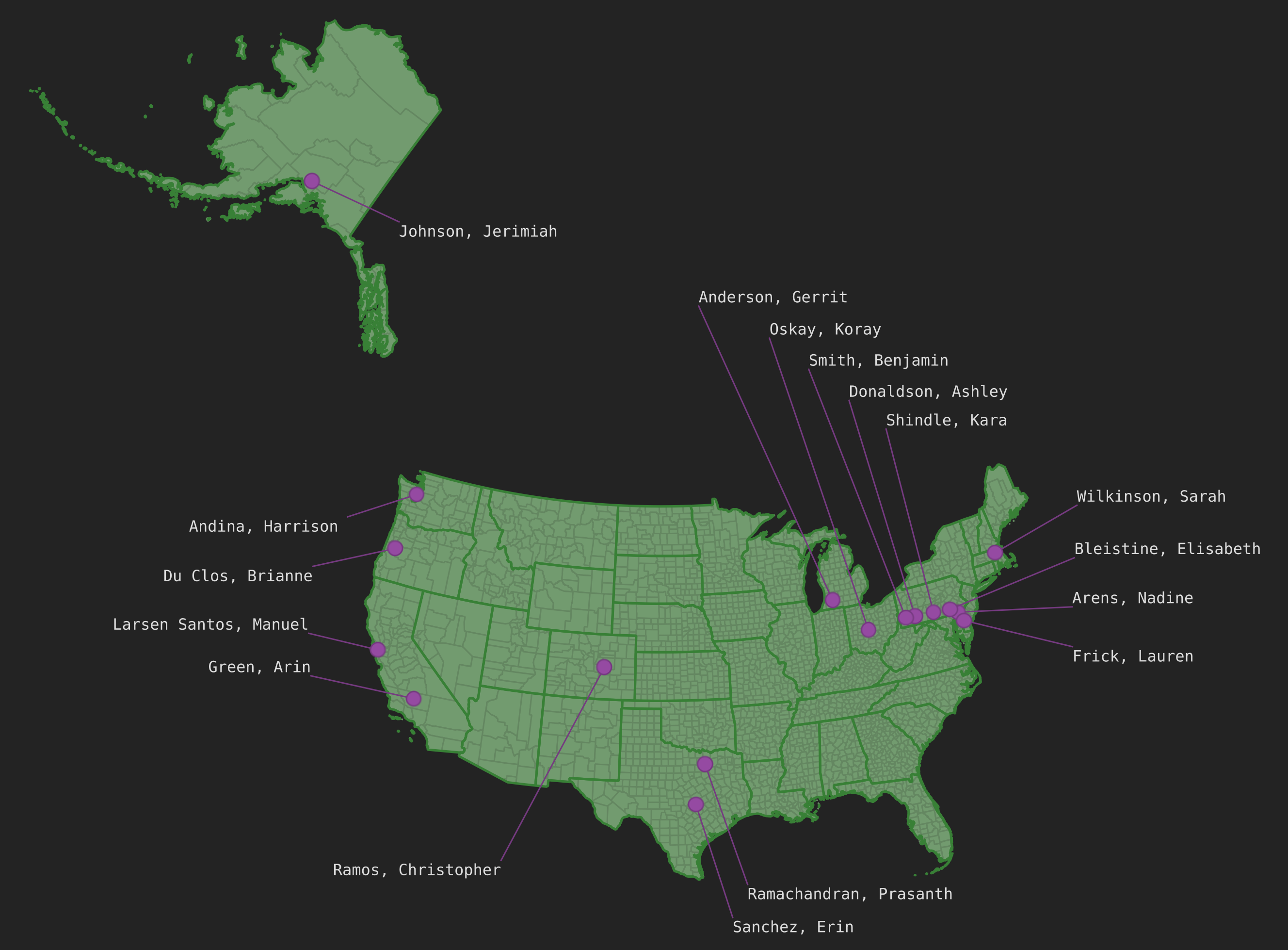
In Lesson 3 of GEOG 868 I played around with PostgreSQL and PostGIS for the first time. For the project at the end you are given a class_roster.txt file that contains a list of students and their postal codes. The task was to join that with data provided earlier in the lesson and then plot the students’ locations on a map in QGIS. Here’s how I went about doing that.
So. Hello again.
A bit of a lull in GEOG 868 progress in the last week, as I crammed the prerequisites for the NASA ARSET course I mentioned last week.
I attended the first session yesterday and enjoyed my second bout of playing with Google Earth Engine (GEE), having played with it briefly during one of the prerequisite courses. The remaining sessions are on the 4th, 9th and 11th August, with a homework assignment due by the 25th. There is plenty to learn about the world of remote sensing, to say the least, but I won’t be spending too much time focused on it just now. If / when I decide to take my Oxford Uni assignment any further then I’ll revisit this stuff. For now I shall be turning my focus back to my spatial database management course.
A fairly database-focussed week. The last of the “refresher” stuff before I move onto actual spatial database stuff.
In the last week I got stuck into GEOG 868 (the Pennsylvania State University Spatial Database Management course I mentioned last week). I started off with a bit of an SQL refresher via SQLBolt and some SQLZOO, then cracked on with GEOG 868 Lesson 1.
So I’ve decided to give weeknotes a go.
What are weeknotes?
At the most basic level they are posts on someone’s blog that generally appear each week. What about a level up from that? Well, they tend to contain some account of what the author of the post got up to in the last week. That might take the form of a detailed list of activities, such as events attended, work completed, or personal endeavours enjoyed. It might also be more reflective, a form of journaling, how things in the last week made one feel. Indeed a weeknote could be a mixture of those things, and more, or less. They are whatever the author makes of them.
I’m going to give them a go, at least for a little while, as a way to encourage myself to write about what I’m getting up with regards to exploring the world of GIS.
I’ve been exploring the world of GIS for a few months now, and it wouldn’t be unreasonable to say I’ve been taking notes in a similar manner to this dog drinking from a hose:
As noted in Hello (GIS) World I was recently working on the first assignment in the QGIS Training Manual. I planned to do 3 things for the assignment:
I am exploring the world of Geographic Information Systems (GIS).
I have been reading the Gentle Introduction to GIS from the QGIS documentation and also working through the QGIS Training Manual. In the last couple of weeks I completed the first assignment.