- blog/
UK Freight Transport System
For the graded assignment in the Introduction to Mapping, Spatial Data and GIS course I completed in June I made the following map:
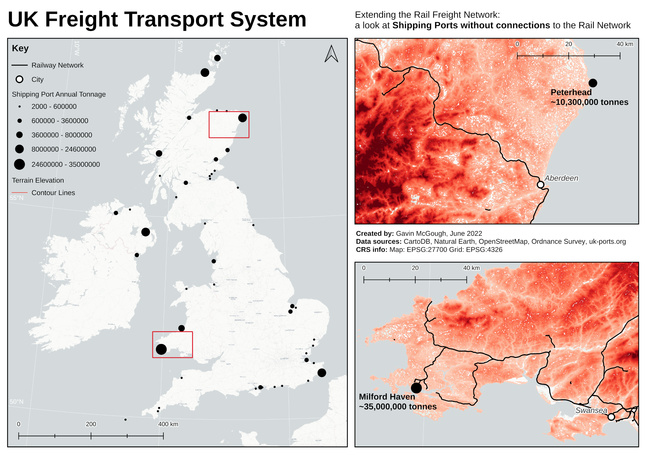
The (naïve) idea behind my map was to mix together the vague and broad terms “supply chain analysis” and “climate change” which led me to the thought: what would be the best shipping port to connect to the rail network next?
The consideration of shipping port busyness covering the “supply chain analysis” angle, and rail freight being a greener form of transport than road haulage covering the “climate change” angle.
My objective was to make a map that demonstrates the skills I learned throughout the course – and my map did that. I can say with a large degree of certainty that this map does not point out the next best shipping ports to connect to the railway network (unless I stumbled across a reasonable conclusion by accident) due to my knowledge of the amount of uncertainty that went into its creation.
Today I’m just sharing the end result, and I will work backwards from there, sharing more about the elements of uncertainty I encountered in separate posts.