GEOG 868: Jen and Barry's Site Selection
·8 mins
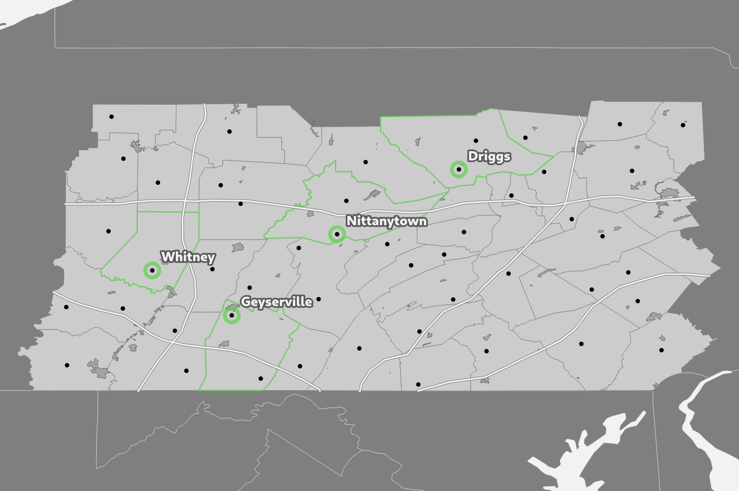
In Lesson 4 of GEOG 868 I completed a site selection using PostGIS.
In Lesson 4 of GEOG 868 I completed a site selection using PostGIS.
A few things I got up to this week:
The Making Maps unit for the Introduction to Mapping, Spatial Data and GIS course I completed in June featured a tourism case study. The exercise that week was to create a tourist map of Melbourne in Australia.
Oops, my first late weeknote! I intended to get it done at the weekend rather than on Wednesday like usual, but that has ended up slipping over to today, Monday. Anyway. What GIS things did I get up to since my last post?
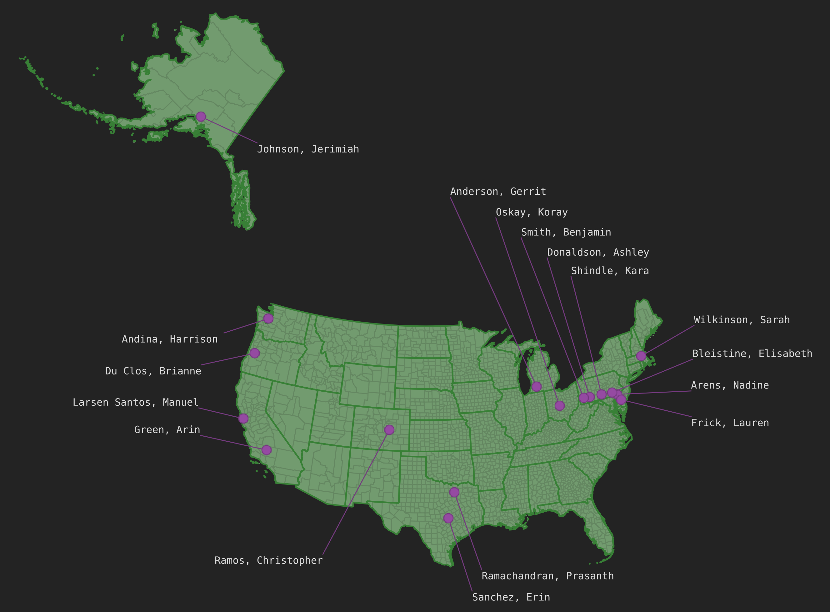
In Lesson 3 of GEOG 868 I played around with PostgreSQL and PostGIS for the first time. For the project at the end you are given a class_roster.txt file that contains a list of students and their postal codes. The task was to join that with data provided earlier in the lesson and then plot the students’ locations on a map in QGIS. Here’s how I went about doing that.
In the last week I got stuck into GEOG 868 (the Pennsylvania State University Spatial Database Management course I mentioned last week). I started off with a bit of an SQL refresher via SQLBolt and some SQLZOO, then cracked on with GEOG 868 Lesson 1.
As noted in Hello (GIS) World I was recently working on the first assignment in the QGIS Training Manual. I planned to do 3 things for the assignment: