- blog/
A map of Melbourne
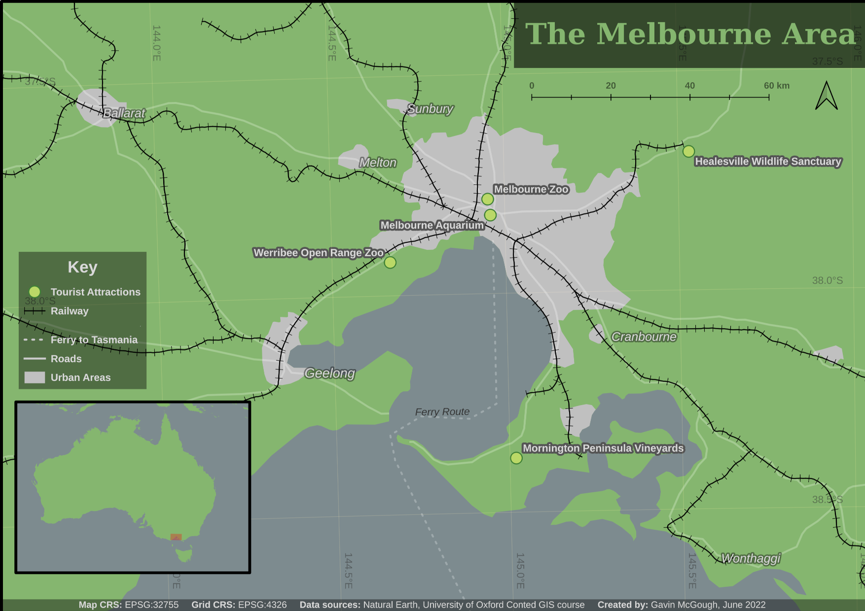
The Making Maps unit for the Introduction to Mapping, Spatial Data and GIS course I completed in June featured a tourism case study. The exercise that week was to create a tourist map of Melbourne in Australia.
Given a single shapefile of point data that marked the locations of a selection of tourist attractions, we were tasked with putting them on a map. The map was to include all your fundamental map features, such as: map body, map border, graticule (coordinate grid), scale bar, north arrow, legend and acknowledgement (title, author, data sources). Oh and an inset map too.
A set of points does not a map make – we were pointed to Natural Earth and DIVA-GIS and told to include whatever data layers we liked.
I spent a few hours on my map, and this is what I came up with:
The blurb I included with my map when I shared it in the forums was as follows:
I decided to try and make a map for folks who might like to take a day trip out of Melbourne while they are visiting. The Wildlife/Scenic locations being mostly outside of Melbourne inspired this. I hid the Great Ocean Road point in the bottom left as it was particularly far away, and without a more detailed road network it looked unconnected. I also added the only Cultural/Historic location outwith Melbourne, Mornington Peninsual Vineyards, as it is within a reasonable distance for day tripping I reckon. And to tempt the more adventurous (with perhaps a weekend trip in mind), I marked on the Ferry Route to Tasmania, which was in the Roads data from Natural Earth.
Was I successful? I’m pretty pleased with my efforts. I think it’s successful. If it were to encourage someone to explore the surrounding Melbourne area while they were there, then it would be truly successful.